Petenwell Flowage (Adams, Wood, Juneau)
Petenwell Flowage in Adams, Wood, and Juneau County, WI
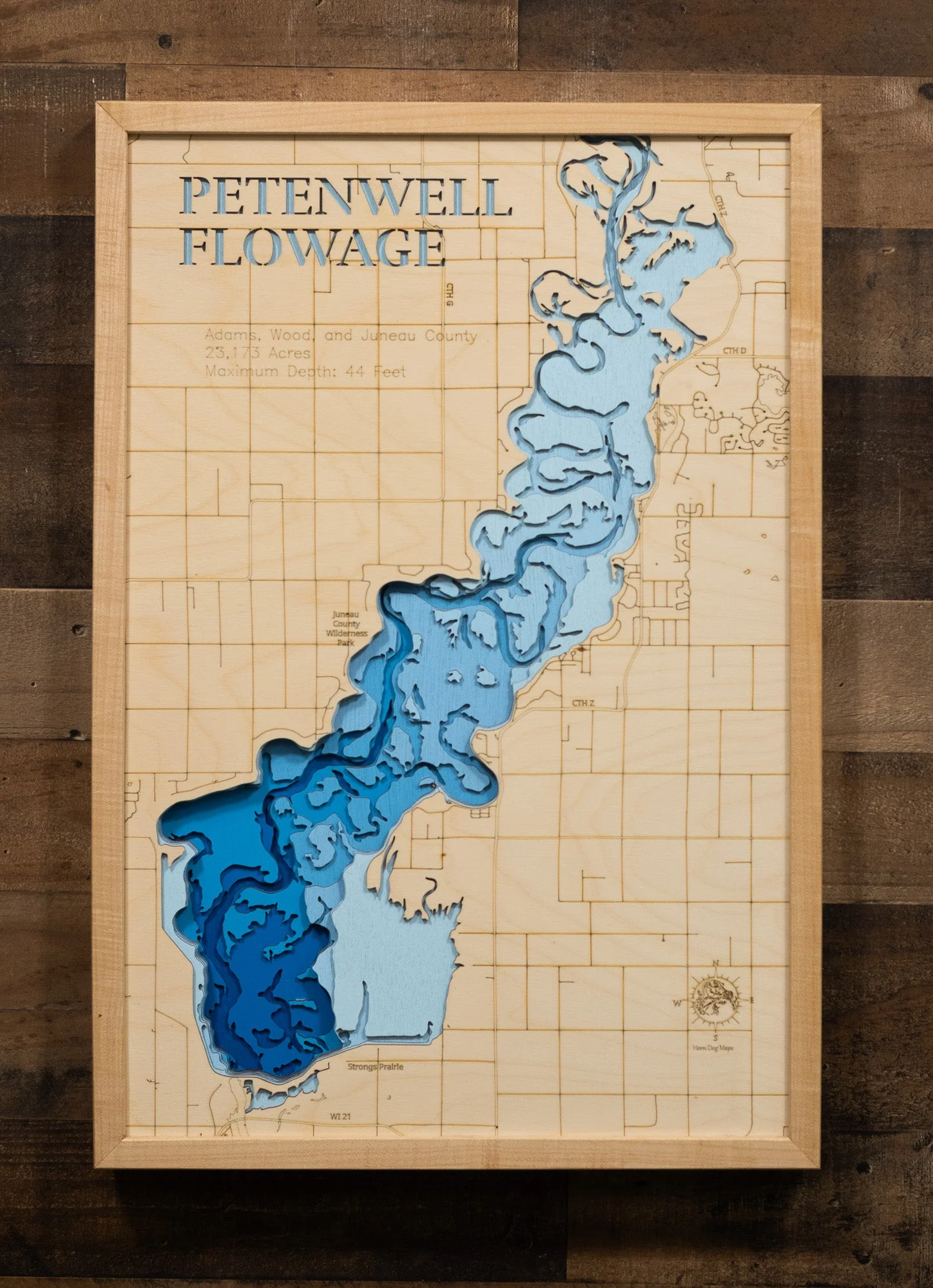
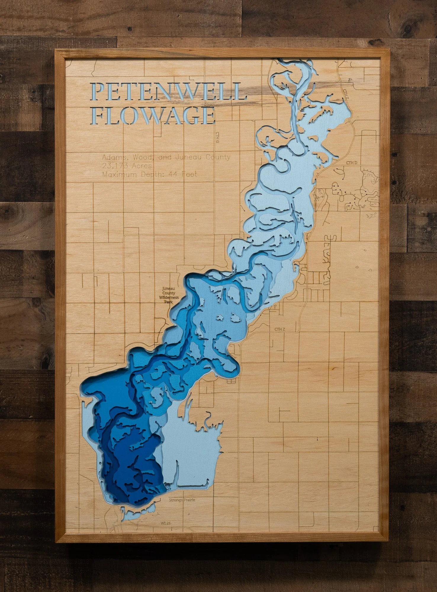
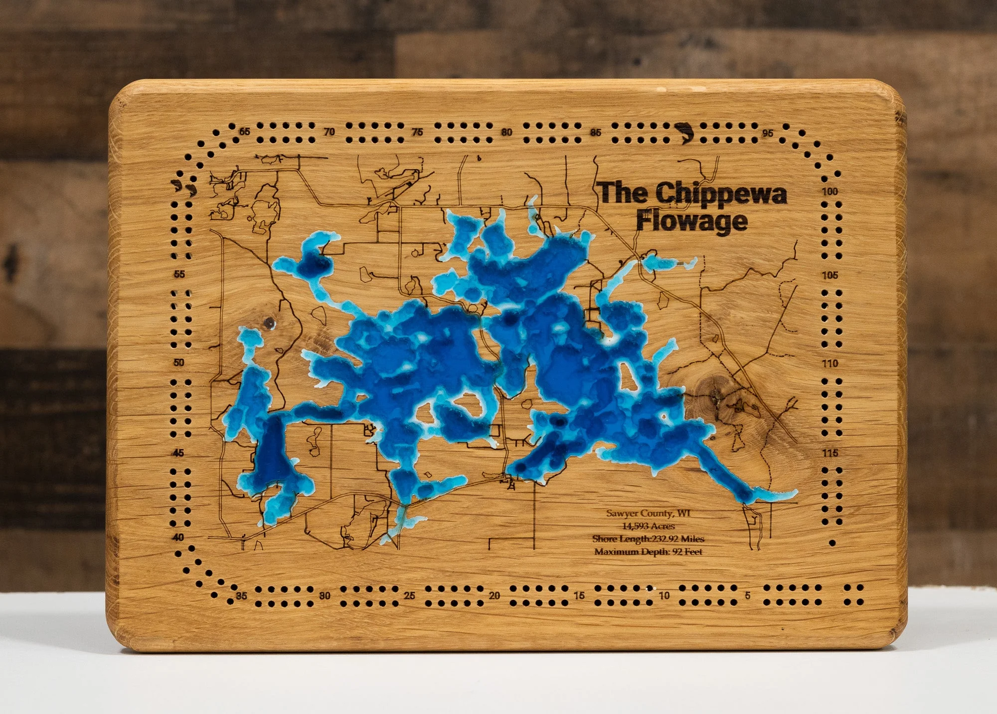
This map has 8 layers
Petenwell Flowage, a massive 23,173-acre artificial lake on the Wisconsin River, is a prominent natural feature located in Adams, Juneau, and Wood counties in central Wisconsin. This expansive Wisconsin flowage, boasting a sprawling shoreline of 101.07 miles, was created by the construction of a hydroelectric dam in 1948. As the second-largest lake entirely within the state's borders, it is known for its wide-open waters and largely undeveloped shoreline, offering a unique and dynamic environment for visitors and wildlife alike.
As a premier destination in central Wisconsin, Petenwell Flowage provides an ideal setting for a wide array of outdoor pursuits. Anglers are drawn to its productive waters for a diverse range of fish species, including Walleye, Musky, Northern Pike, Bass, and panfish. The flowage's vast surface is well-suited for diverse boating activities, from sailing and watersports to fishing, allowing visitors to fully immerse themselves in the surrounding natural beauty. Its status as a year-round destination, with opportunities for ice fishing and eagle watching, makes Petenwell Flowage a cherished choice for those seeking a classic Wisconsin lake experience.
Dimensions:
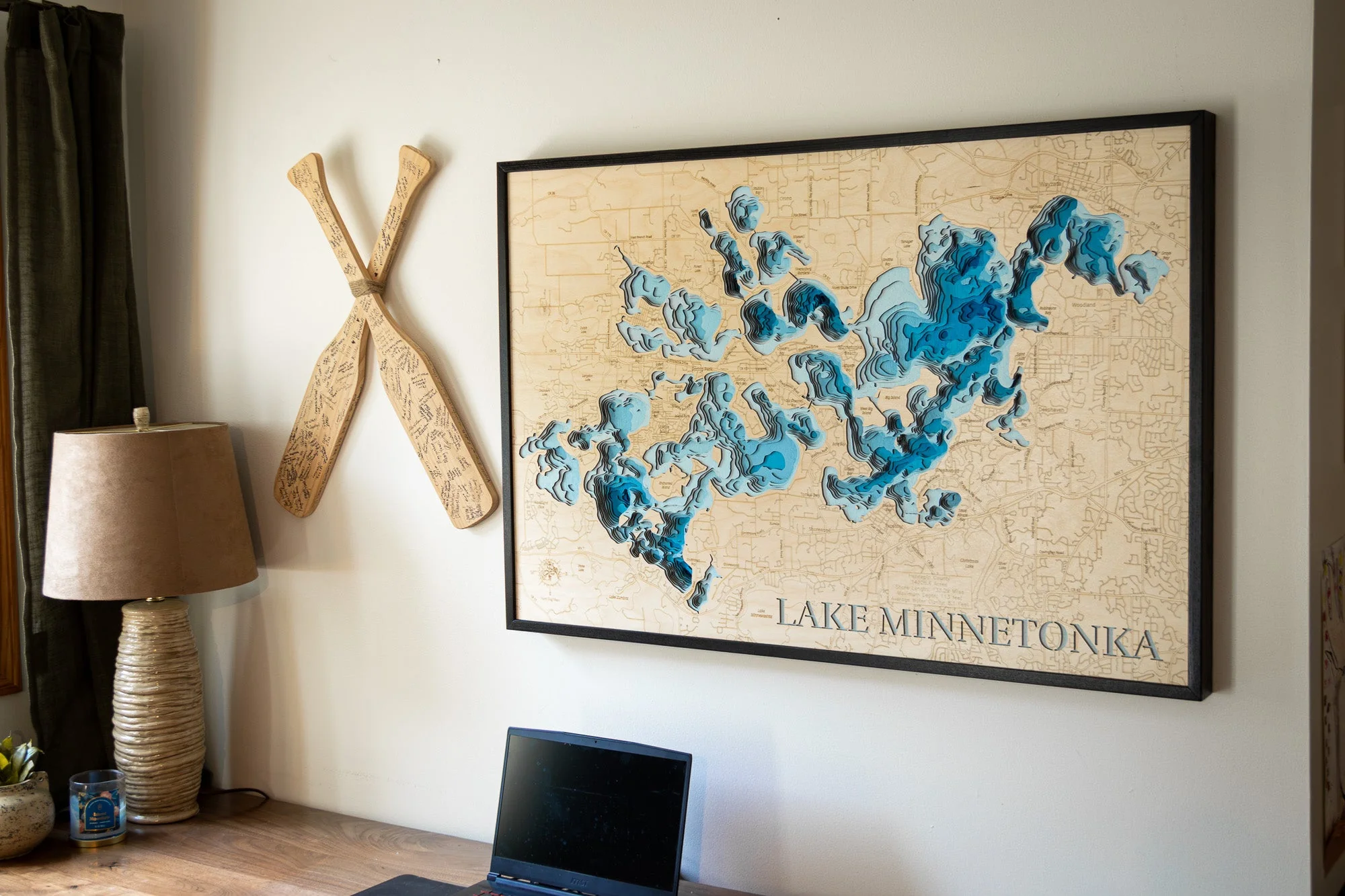
Small: 8"x12"
Medium: 12"x18"
Large: 16"x24"
Extra Large: 20"x30"
XX Large: 24"x36"
Gigantic 30"x45"
HD Extra Large: 20"x30" - 15 Layers
HD XX Large: 24"x36" - 15 Layers
HD Gigantic 30"x45" - 15 Layers
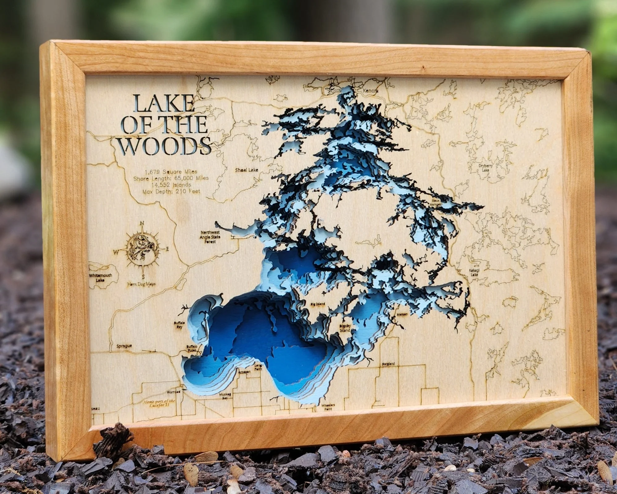
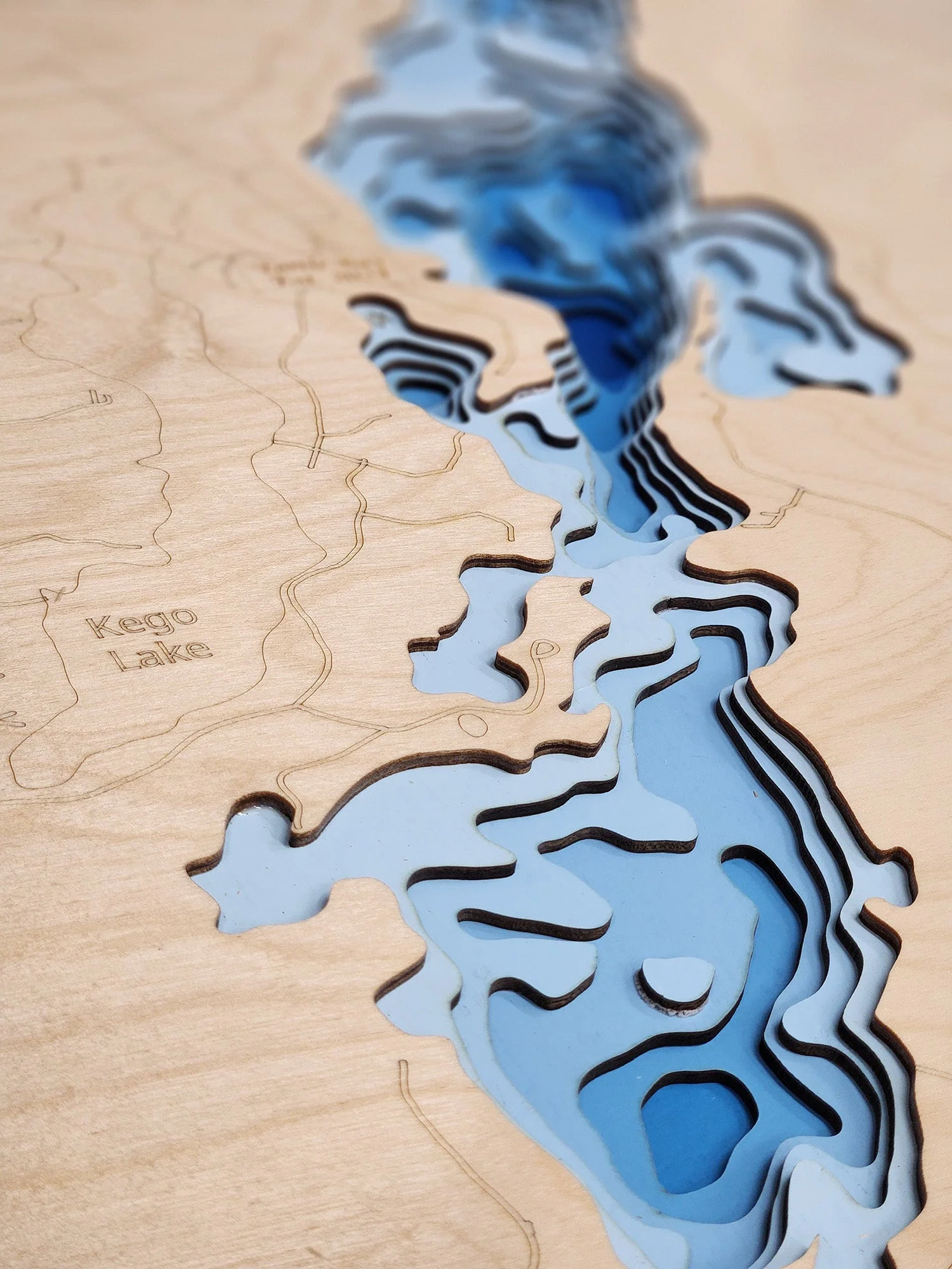
The difference between standard and HD maps is the number of layers. Standard maps have 1 land layer and 7 water layers. " The HD lake maps have 1 land layer and 14 water layers. So twice the detail. The HD Maps are limited to Extra Large, " XX Large, and Gigantic sizes only. On the smaller sizes the depth change of the wood is too extreme and you end up losing detail."
Original: $175.00
-70%$175.00
$52.50More Images
Petenwell Flowage (Adams, Wood, Juneau)
Petenwell Flowage in Adams, Wood, and Juneau County, WI
This map has 8 layers
Petenwell Flowage, a massive 23,173-acre artificial lake on the Wisconsin River, is a prominent natural feature located in Adams, Juneau, and Wood counties in central Wisconsin. This expansive Wisconsin flowage, boasting a sprawling shoreline of 101.07 miles, was created by the construction of a hydroelectric dam in 1948. As the second-largest lake entirely within the state's borders, it is known for its wide-open waters and largely undeveloped shoreline, offering a unique and dynamic environment for visitors and wildlife alike.
As a premier destination in central Wisconsin, Petenwell Flowage provides an ideal setting for a wide array of outdoor pursuits. Anglers are drawn to its productive waters for a diverse range of fish species, including Walleye, Musky, Northern Pike, Bass, and panfish. The flowage's vast surface is well-suited for diverse boating activities, from sailing and watersports to fishing, allowing visitors to fully immerse themselves in the surrounding natural beauty. Its status as a year-round destination, with opportunities for ice fishing and eagle watching, makes Petenwell Flowage a cherished choice for those seeking a classic Wisconsin lake experience.
Dimensions:
Small: 8"x12"
Medium: 12"x18"
Large: 16"x24"
Extra Large: 20"x30"
XX Large: 24"x36"
Gigantic 30"x45"
HD Extra Large: 20"x30" - 15 Layers
HD XX Large: 24"x36" - 15 Layers
HD Gigantic 30"x45" - 15 Layers
The difference between standard and HD maps is the number of layers. Standard maps have 1 land layer and 7 water layers. " The HD lake maps have 1 land layer and 14 water layers. So twice the detail. The HD Maps are limited to Extra Large, " XX Large, and Gigantic sizes only. On the smaller sizes the depth change of the wood is too extreme and you end up losing detail."
Product Information
Product Information
Shipping & Returns
Shipping & Returns
Description
Petenwell Flowage in Adams, Wood, and Juneau County, WI
This map has 8 layers
Petenwell Flowage, a massive 23,173-acre artificial lake on the Wisconsin River, is a prominent natural feature located in Adams, Juneau, and Wood counties in central Wisconsin. This expansive Wisconsin flowage, boasting a sprawling shoreline of 101.07 miles, was created by the construction of a hydroelectric dam in 1948. As the second-largest lake entirely within the state's borders, it is known for its wide-open waters and largely undeveloped shoreline, offering a unique and dynamic environment for visitors and wildlife alike.
As a premier destination in central Wisconsin, Petenwell Flowage provides an ideal setting for a wide array of outdoor pursuits. Anglers are drawn to its productive waters for a diverse range of fish species, including Walleye, Musky, Northern Pike, Bass, and panfish. The flowage's vast surface is well-suited for diverse boating activities, from sailing and watersports to fishing, allowing visitors to fully immerse themselves in the surrounding natural beauty. Its status as a year-round destination, with opportunities for ice fishing and eagle watching, makes Petenwell Flowage a cherished choice for those seeking a classic Wisconsin lake experience.
Dimensions:
Small: 8"x12"
Medium: 12"x18"
Large: 16"x24"
Extra Large: 20"x30"
XX Large: 24"x36"
Gigantic 30"x45"
HD Extra Large: 20"x30" - 15 Layers
HD XX Large: 24"x36" - 15 Layers
HD Gigantic 30"x45" - 15 Layers
The difference between standard and HD maps is the number of layers. Standard maps have 1 land layer and 7 water layers. " The HD lake maps have 1 land layer and 14 water layers. So twice the detail. The HD Maps are limited to Extra Large, " XX Large, and Gigantic sizes only. On the smaller sizes the depth change of the wood is too extreme and you end up losing detail."