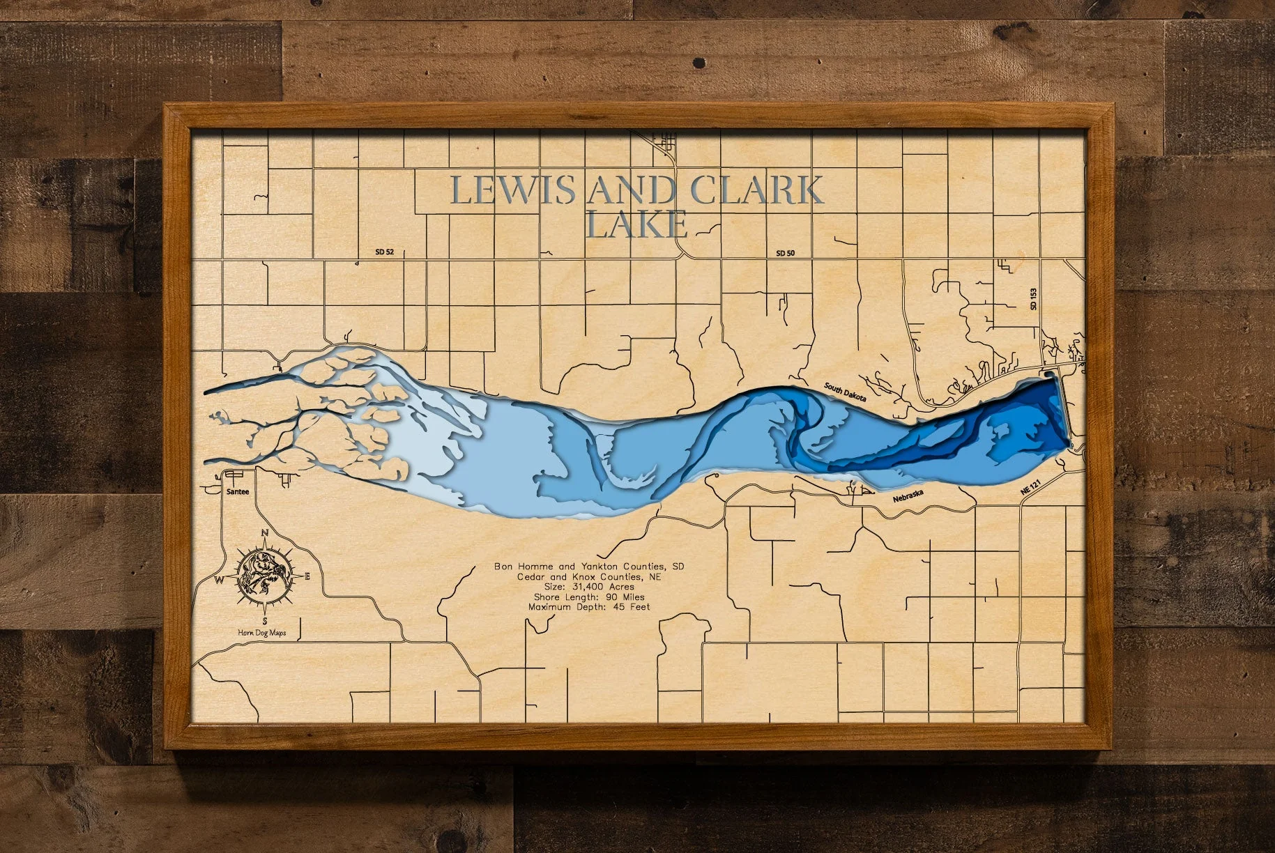
Lewis and Clark (Bon Homme, Yankton, Cedar, Knox)
Lewis and Clark Lake in Bon Homme and Yankton Counties, South Dakota and Cedar and Knox Counties, Nebraska
This lake has 8 Layers or 15 Layers for HD Version
Lewis and Clark Lake, a significant 31,400-acre reservoir on the Missouri River, forms a substantial portion of the border between South Dakota (Bon Homme and Yankton Counties) and Nebraska (Cedar and Knox Counties). Named after the famed explorers, Meriwether Lewis and William Clark, the lake stretches approximately 25 miles in length and features over 90 miles of shoreline. This popular recreational destination offers a wide array of activities, including boating, sailing, and swimming. Anglers are drawn to its waters for the excellent fishing opportunities, with species such as walleye, northern pike, sauger, and various bass and catfish being common catches.
The shores of Lewis and Clark Lake are dotted with numerous state recreation areas and access points on both the Nebraska and South Dakota sides, offering campgrounds, picnic areas, and trails for hiking and biking. The Lewis and Clark National Historic Trail runs along the lake, highlighting the historical significance of the area. The Gavins Point Dam, which impounds the lake, is a major feature, and the nearby Lewis and Clark Visitor Center provides insights into the area's history and ecology. While the lake faces challenges with sedimentation, it remains a vital recreational and natural resource, attracting visitors to enjoy its scenic beauty and outdoor activities year-round, including ice fishing in the winter.
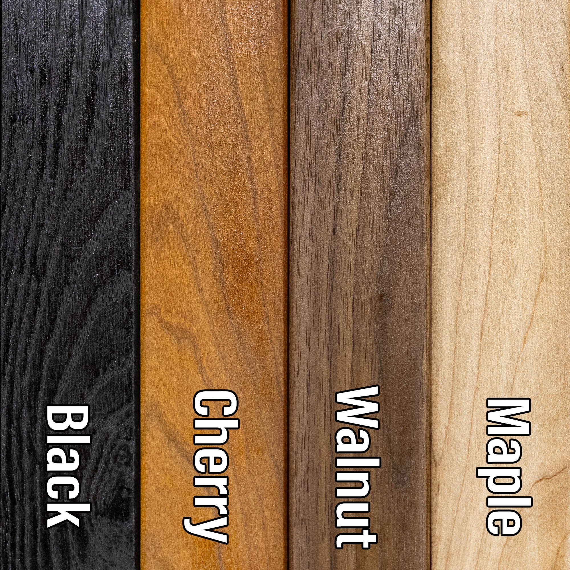
Dimensions:
Small: 8"x12"
Medium: 12"x18"
Large: 16"x24"
Extra Large: 20"x30"
XX Large: 24"x36"
Gigantic 30"x45"
HD Extra Large: 20"x30" - 15 Layers
HD XX Large: 24"x36" - 15 Layers
HD Gigantic 30"x45" - 15 Layers
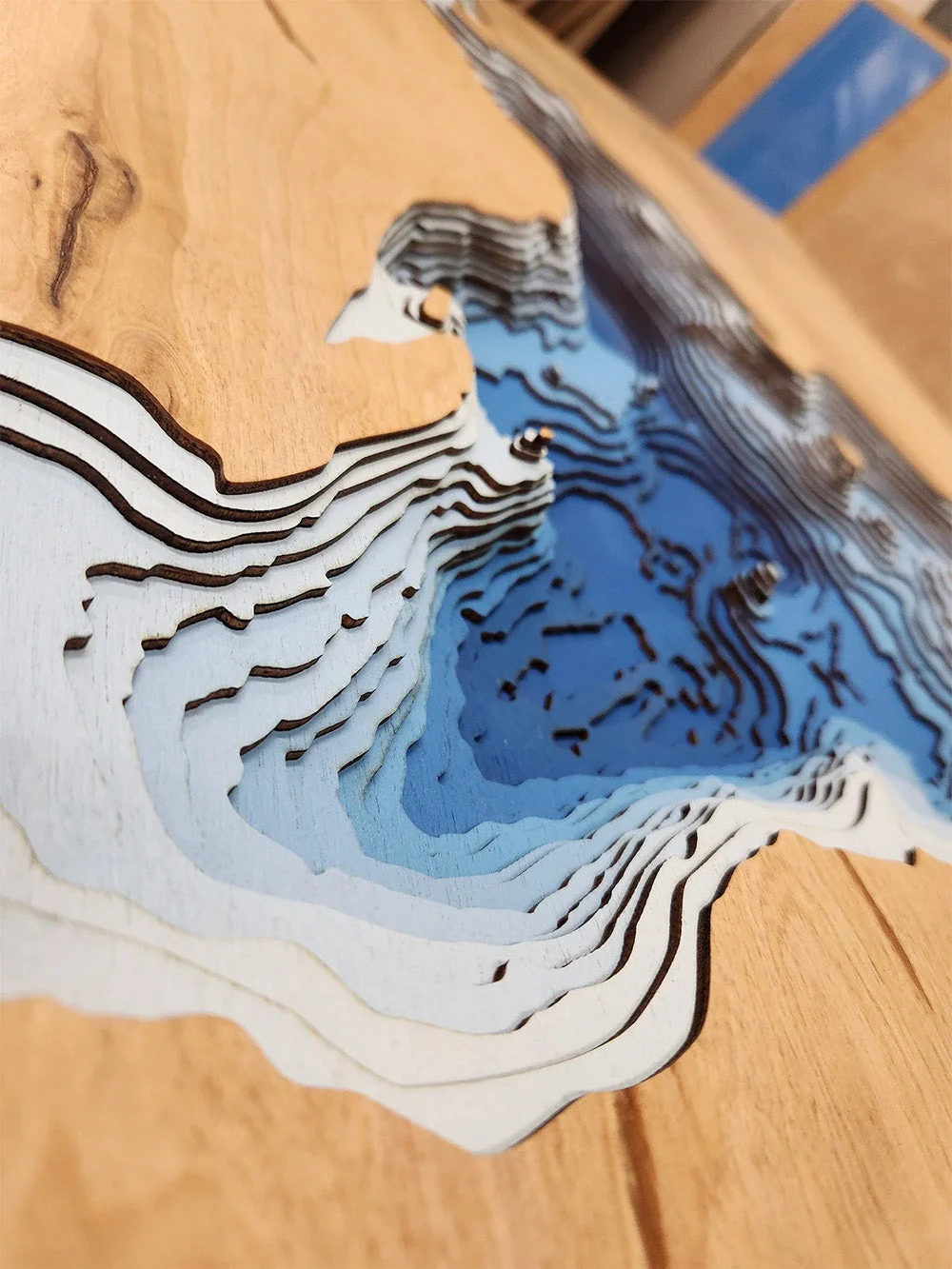
The difference between standard and HD maps is the number of layers. Standard maps have 1 land layer and 7 water layers. " The HD lake maps have 1 land layer and 14 water layers. So twice the detail. The HD Maps are limited to Extra Large, " XX Large, and Gigantic sizes only. On the smaller sizes the depth change of the wood is too extreme and you end up losing detail."
Original: $175.00
-70%$175.00
$52.50More Images

Lewis and Clark (Bon Homme, Yankton, Cedar, Knox)
Lewis and Clark Lake in Bon Homme and Yankton Counties, South Dakota and Cedar and Knox Counties, Nebraska
This lake has 8 Layers or 15 Layers for HD Version
Lewis and Clark Lake, a significant 31,400-acre reservoir on the Missouri River, forms a substantial portion of the border between South Dakota (Bon Homme and Yankton Counties) and Nebraska (Cedar and Knox Counties). Named after the famed explorers, Meriwether Lewis and William Clark, the lake stretches approximately 25 miles in length and features over 90 miles of shoreline. This popular recreational destination offers a wide array of activities, including boating, sailing, and swimming. Anglers are drawn to its waters for the excellent fishing opportunities, with species such as walleye, northern pike, sauger, and various bass and catfish being common catches.
The shores of Lewis and Clark Lake are dotted with numerous state recreation areas and access points on both the Nebraska and South Dakota sides, offering campgrounds, picnic areas, and trails for hiking and biking. The Lewis and Clark National Historic Trail runs along the lake, highlighting the historical significance of the area. The Gavins Point Dam, which impounds the lake, is a major feature, and the nearby Lewis and Clark Visitor Center provides insights into the area's history and ecology. While the lake faces challenges with sedimentation, it remains a vital recreational and natural resource, attracting visitors to enjoy its scenic beauty and outdoor activities year-round, including ice fishing in the winter.
Dimensions:
Small: 8"x12"
Medium: 12"x18"
Large: 16"x24"
Extra Large: 20"x30"
XX Large: 24"x36"
Gigantic 30"x45"
HD Extra Large: 20"x30" - 15 Layers
HD XX Large: 24"x36" - 15 Layers
HD Gigantic 30"x45" - 15 Layers
The difference between standard and HD maps is the number of layers. Standard maps have 1 land layer and 7 water layers. " The HD lake maps have 1 land layer and 14 water layers. So twice the detail. The HD Maps are limited to Extra Large, " XX Large, and Gigantic sizes only. On the smaller sizes the depth change of the wood is too extreme and you end up losing detail."
Product Information
Product Information
Shipping & Returns
Shipping & Returns
Description
Lewis and Clark Lake in Bon Homme and Yankton Counties, South Dakota and Cedar and Knox Counties, Nebraska
This lake has 8 Layers or 15 Layers for HD Version
Lewis and Clark Lake, a significant 31,400-acre reservoir on the Missouri River, forms a substantial portion of the border between South Dakota (Bon Homme and Yankton Counties) and Nebraska (Cedar and Knox Counties). Named after the famed explorers, Meriwether Lewis and William Clark, the lake stretches approximately 25 miles in length and features over 90 miles of shoreline. This popular recreational destination offers a wide array of activities, including boating, sailing, and swimming. Anglers are drawn to its waters for the excellent fishing opportunities, with species such as walleye, northern pike, sauger, and various bass and catfish being common catches.
The shores of Lewis and Clark Lake are dotted with numerous state recreation areas and access points on both the Nebraska and South Dakota sides, offering campgrounds, picnic areas, and trails for hiking and biking. The Lewis and Clark National Historic Trail runs along the lake, highlighting the historical significance of the area. The Gavins Point Dam, which impounds the lake, is a major feature, and the nearby Lewis and Clark Visitor Center provides insights into the area's history and ecology. While the lake faces challenges with sedimentation, it remains a vital recreational and natural resource, attracting visitors to enjoy its scenic beauty and outdoor activities year-round, including ice fishing in the winter.
Dimensions:
Small: 8"x12"
Medium: 12"x18"
Large: 16"x24"
Extra Large: 20"x30"
XX Large: 24"x36"
Gigantic 30"x45"
HD Extra Large: 20"x30" - 15 Layers
HD XX Large: 24"x36" - 15 Layers
HD Gigantic 30"x45" - 15 Layers
The difference between standard and HD maps is the number of layers. Standard maps have 1 land layer and 7 water layers. " The HD lake maps have 1 land layer and 14 water layers. So twice the detail. The HD Maps are limited to Extra Large, " XX Large, and Gigantic sizes only. On the smaller sizes the depth change of the wood is too extreme and you end up losing detail."