Great Pond (Kennebec)
Great Pond in Kennebec County, ME
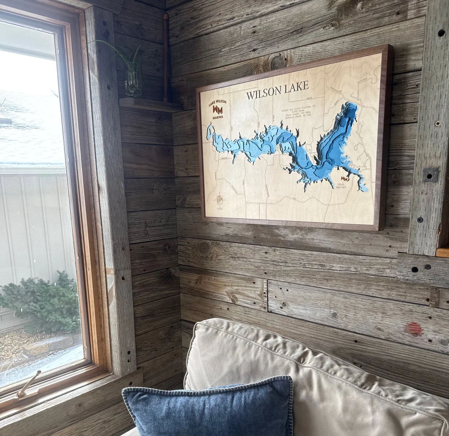
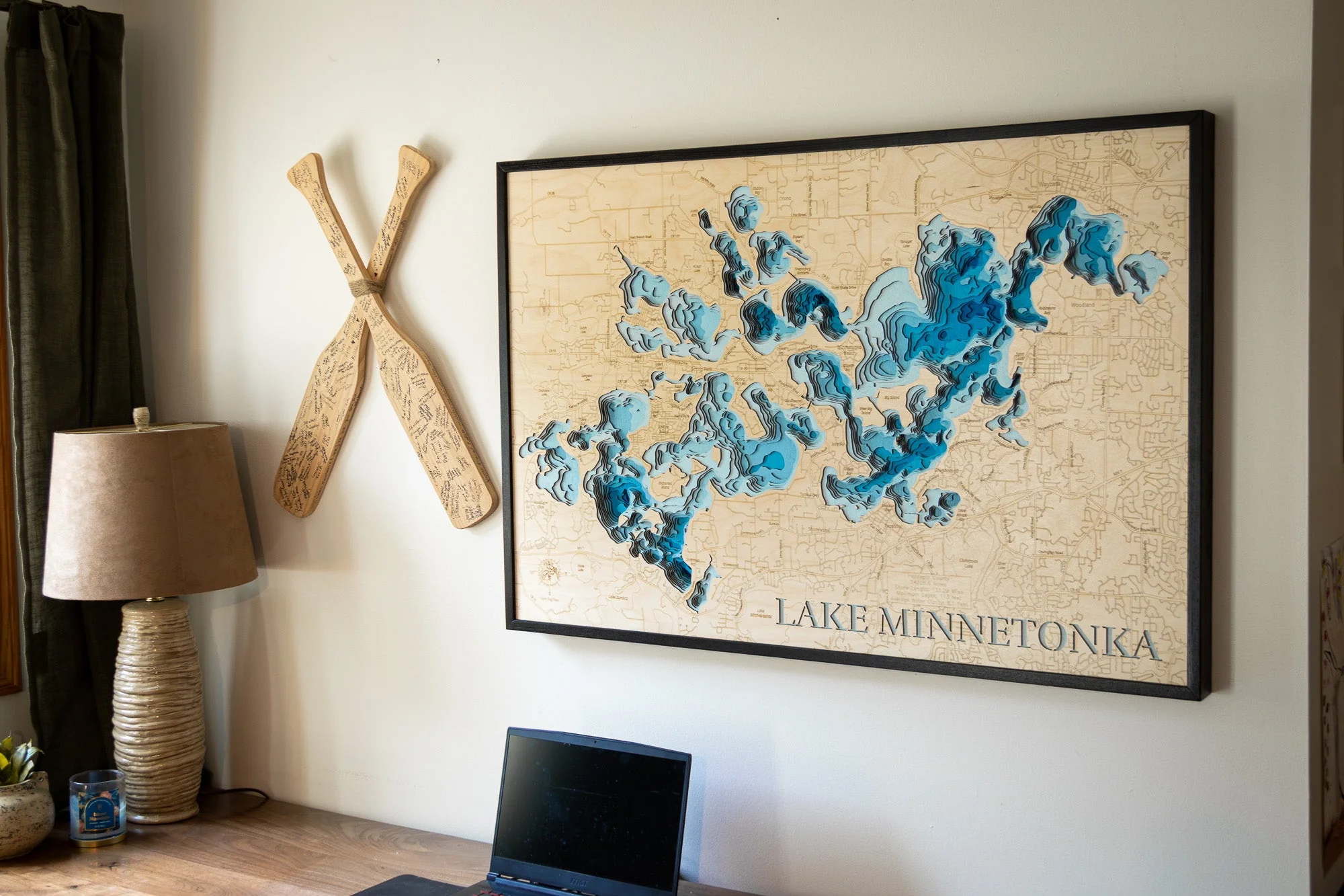
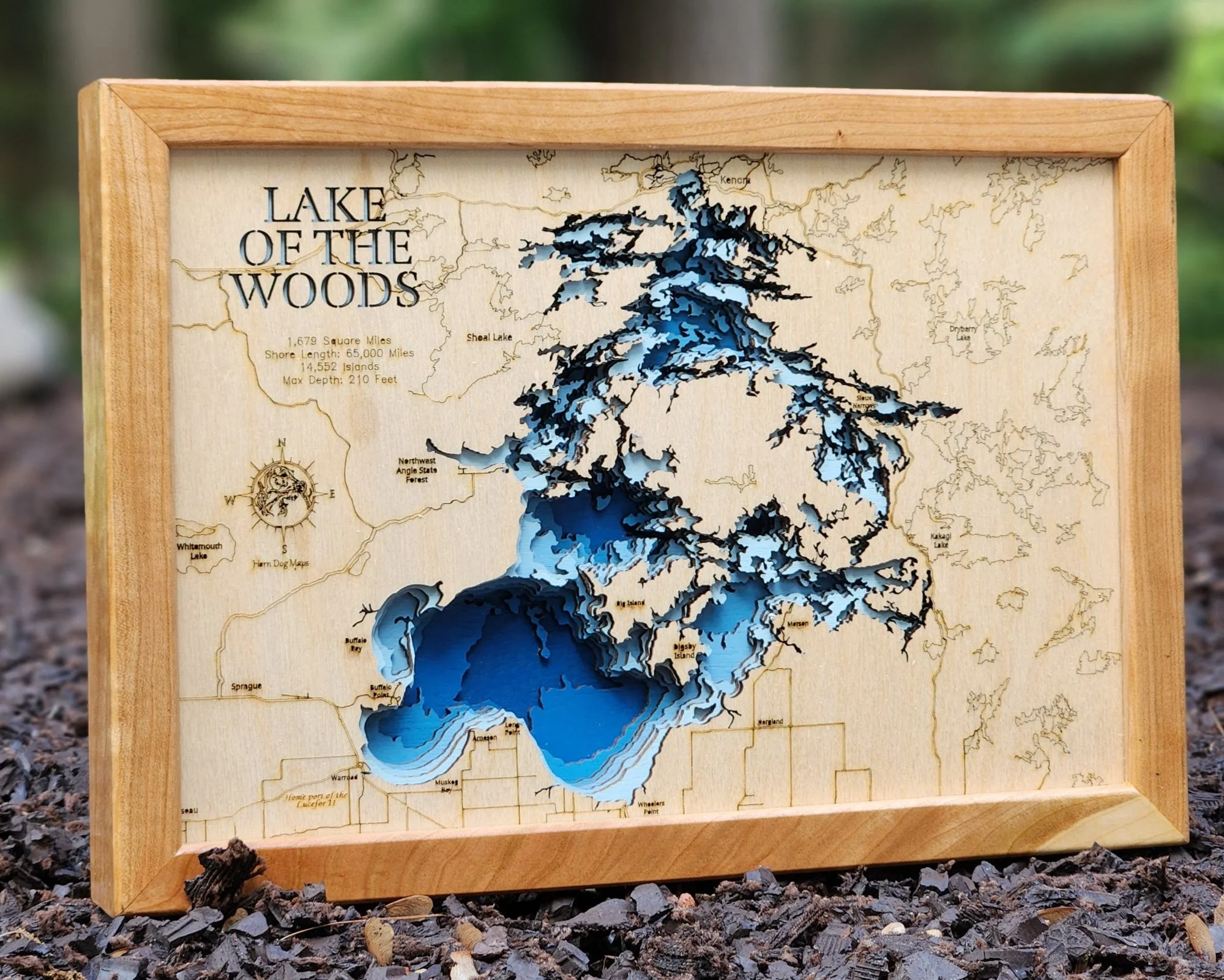
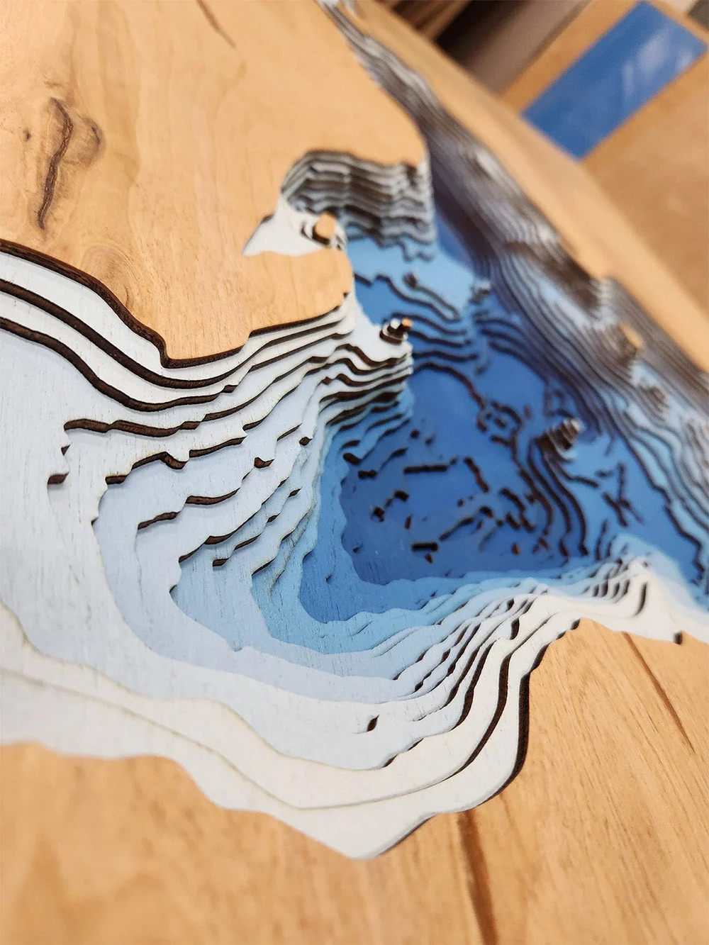
This lake has 8 Layers or 15 Layers for HD Version
Great Pond is one of Maine’s most iconic bodies of water, located in the Belgrade Lakes region. As the largest of the seven Belgrade Lakes, it offers a sprawling expanse of scenic shoreline, quiet coves, and open water ideal for all types of lake recreation. The surrounding region is a favorite summer destination, with camps, vacation homes, and family resorts dotting the wooded shores.
The lake’s clear water and natural surroundings make it perfect for boating, paddling, and fishing. Anglers enjoy targeting species like smallmouth and largemouth bass, brown trout, and landlocked salmon. With its vibrant seasonal community, Great Pond blends small-town Maine charm with the tranquility of untouched nature, providing a timeless getaway for outdoor enthusiasts and vacationers alike.
Dimensions:
Small: 8"x12"
Medium: 12"x18"
Large: 16"x24"
Extra Large: 20"x30"
XX Large: 24"x36"
Gigantic 30"x45"
HD Extra Large: 20"x30" - 15 Layers
HD XX Large: 24"x36" - 15 Layers
HD Gigantic 30"x45" - 15 Layers
The difference between standard and HD maps is the number of layers. Standard maps have 1 land layer and 7 water layers. " The HD lake maps have 1 land layer and 14 water layers. So twice the detail. The HD Maps are limited to Extra Large, " XX Large, and Gigantic sizes only. On the smaller sizes the depth change of the wood is too extreme and you end up losing detail."
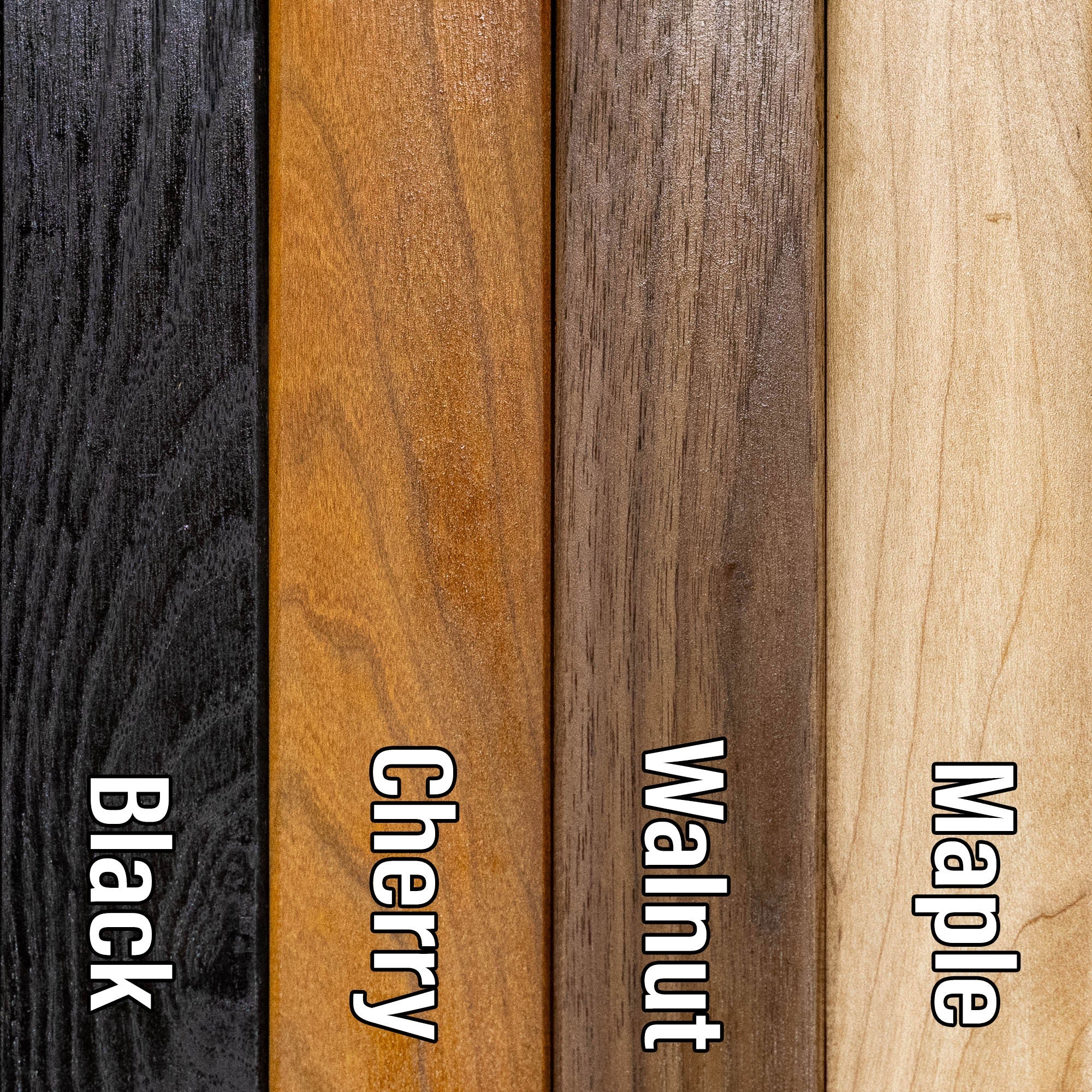
Original: $175.00
-70%$175.00
$52.50More Images
Great Pond (Kennebec)
Great Pond in Kennebec County, ME
This lake has 8 Layers or 15 Layers for HD Version
Great Pond is one of Maine’s most iconic bodies of water, located in the Belgrade Lakes region. As the largest of the seven Belgrade Lakes, it offers a sprawling expanse of scenic shoreline, quiet coves, and open water ideal for all types of lake recreation. The surrounding region is a favorite summer destination, with camps, vacation homes, and family resorts dotting the wooded shores.
The lake’s clear water and natural surroundings make it perfect for boating, paddling, and fishing. Anglers enjoy targeting species like smallmouth and largemouth bass, brown trout, and landlocked salmon. With its vibrant seasonal community, Great Pond blends small-town Maine charm with the tranquility of untouched nature, providing a timeless getaway for outdoor enthusiasts and vacationers alike.
Dimensions:
Small: 8"x12"
Medium: 12"x18"
Large: 16"x24"
Extra Large: 20"x30"
XX Large: 24"x36"
Gigantic 30"x45"
HD Extra Large: 20"x30" - 15 Layers
HD XX Large: 24"x36" - 15 Layers
HD Gigantic 30"x45" - 15 Layers
The difference between standard and HD maps is the number of layers. Standard maps have 1 land layer and 7 water layers. " The HD lake maps have 1 land layer and 14 water layers. So twice the detail. The HD Maps are limited to Extra Large, " XX Large, and Gigantic sizes only. On the smaller sizes the depth change of the wood is too extreme and you end up losing detail."
Product Information
Product Information
Shipping & Returns
Shipping & Returns
Description
Great Pond in Kennebec County, ME
This lake has 8 Layers or 15 Layers for HD Version
Great Pond is one of Maine’s most iconic bodies of water, located in the Belgrade Lakes region. As the largest of the seven Belgrade Lakes, it offers a sprawling expanse of scenic shoreline, quiet coves, and open water ideal for all types of lake recreation. The surrounding region is a favorite summer destination, with camps, vacation homes, and family resorts dotting the wooded shores.
The lake’s clear water and natural surroundings make it perfect for boating, paddling, and fishing. Anglers enjoy targeting species like smallmouth and largemouth bass, brown trout, and landlocked salmon. With its vibrant seasonal community, Great Pond blends small-town Maine charm with the tranquility of untouched nature, providing a timeless getaway for outdoor enthusiasts and vacationers alike.
Dimensions:
Small: 8"x12"
Medium: 12"x18"
Large: 16"x24"
Extra Large: 20"x30"
XX Large: 24"x36"
Gigantic 30"x45"
HD Extra Large: 20"x30" - 15 Layers
HD XX Large: 24"x36" - 15 Layers
HD Gigantic 30"x45" - 15 Layers
The difference between standard and HD maps is the number of layers. Standard maps have 1 land layer and 7 water layers. " The HD lake maps have 1 land layer and 14 water layers. So twice the detail. The HD Maps are limited to Extra Large, " XX Large, and Gigantic sizes only. On the smaller sizes the depth change of the wood is too extreme and you end up losing detail."